Pike/Pine Protected Bike Lanes: Outreach and Recommendations

We partnered with other community organizations to find out what people and businesses need from their street.

Central Seattle Greenways has been advocating for protected bike lanes in the Pike/Pine corridor for several years. So when Seattle City Council passed a resolution in the summer of 2018 requiring temporary infrastructure be installed in 2019, we rolled up our sleeves.

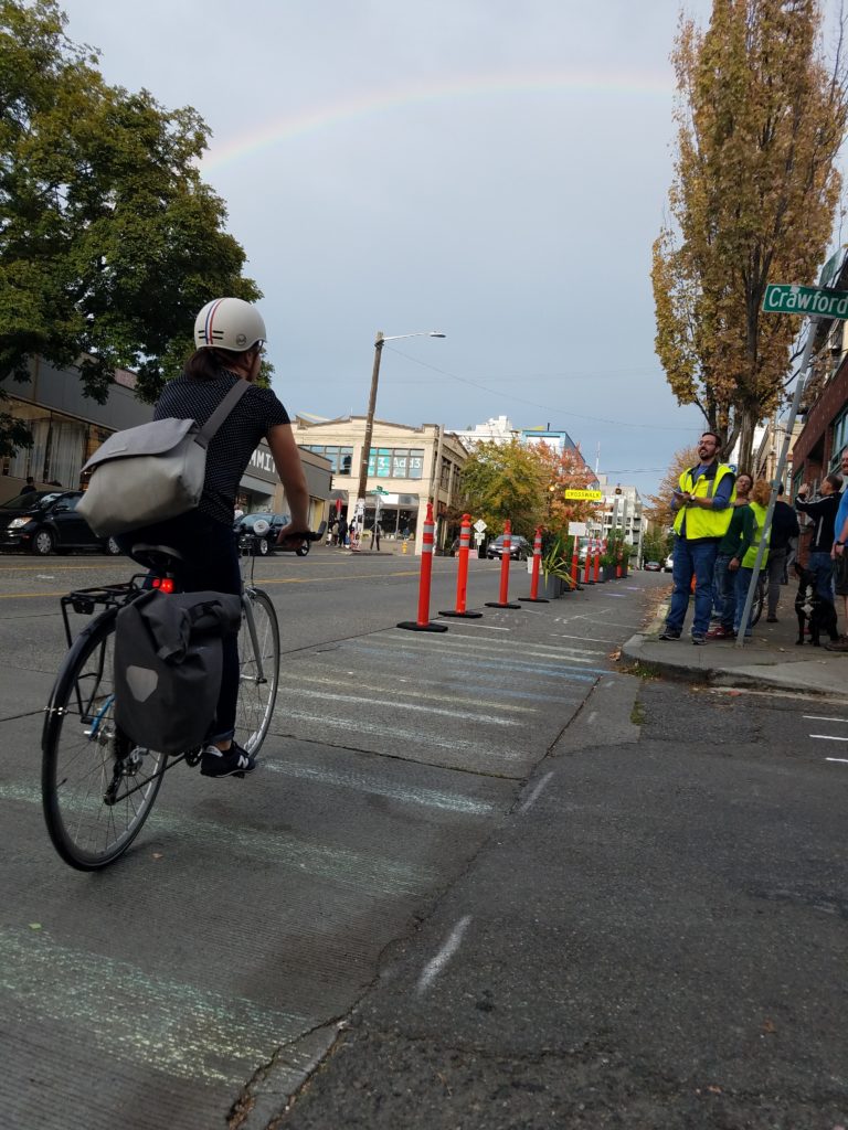
Our pop-up protected bike lane showed people what a lane might look like.

Done right, protected bike lanes not only increase the number of people biking and keep them safe, but the lanes improve conditions for people walking and rolling, boost local business sales, and enhance the neighborhood. It’s important the City get the design right in this vital and vibrant corridor. In order to advocate effectively for the needs of people who live, work, and travel in the corridor, we wanted to find out more about how people use the street and what the broader community prioritizes.

To that end, we partnered with Capitol Hill EcoDistrict, Cascade Bike Club, the Capitol Hill Community Council, and other community organizations to create a pop-up protected bike lane for PARK(ing) Day, conduct direct business outreach, host a community design workshop, and distribute an online survey.

150 community members attended the workshop to discuss the street design.

We’ve shared all of our data — every comment, every statistic, every bit of information we gleaned — with the Seattle Department of Transportation (SDOT), and now we’re sharing our summary and analysis along with recommendations for the design of the corridor. (You can download the full report below.)

Community Priorities

Several strong priorities emerged from our community outreach. We believe each of these priorities is important, and that we can have a street design that meets all of these goals:

  • Pedestrian safety and comfort
  • A continuous, safe, intuitive bike route
  • Ample loading zones for businesses and passengers
  • Clear, predictable traffic flow for all users

Recommendations

Given the priorities and concerns that surfaced, we have some recommendations for SDOT in designing the street.

Long-term
Based on our conversations with SDOT, we presented two options to the community: Option 1 was to build separate one-way lanes on Pike between Broadway and Minor/Melrose, and Option 2 was to build a two-way bikeway on the north side of Pike for those blocks. But at the workshop, through the survey, during business outreach, and in other conversations, we often heard, unbidden, a strong desire for something different: one-way streets all the way to Broadway with a westbound lane entirely on Pine and an eastbound lane entirely on Pike. Creating a couplet of one-way streets all the way to Broadway provides clarity for people walking, biking, and driving; delivers a more intuitive route that cyclists are more likely to use; and shares the perceived burden and benefits of a bike lane for business owners on both Pike and Pine.

We believe this option deserves careful study and consideration by the City. Our strong recommendation is that SDOT construct the temporary bike lanes between Broadway and Minor/Melrose in a way that does not preclude extending the Pike Pine Renaissance street design all the way to Broadway in a few years.

Between the two options on Pike, there was no consensus about whether to separate the directional lanes (one on each side of the street) or to create a two-way bikeway, like the ones on Broadway and 2nd Ave. The general opinion is that separated lanes, especially given the grade and resulting speed differential, are preferred if the transition for eastbound riders from the left side of Pike to the right is handled well (so that it’s clear to all users what’s happening, doesn’t require people biking to wait through multiple light phases to move over, and is safe).

There was no strong consensus about which street the bike lane should use to cross from Pike to Pine, but workshop groups and survey respondents both requested that the crossover street be calmed and that signals and signage be clear.

Short-term
If the transition from the existing left-hand eastbound lanes on Pike to right-hand eastbound lanes can be managed so that it is safe, intuitive, and sensible to people biking, we recommend separating the directional lanes on either side of Pike.

We’ve seen an early-stage proposal from SDOT to install temporary lanes on either side of Pike all the way down to Hubbell, using the light at Hubbell to move eastbound cyclists to the right side of the street via a diagonal cross-bike (similar to Westlake and 9th), with a two-way bikeway between Hubbell and 8th Avenue. We believe this is an elegant interim solution that avoids the challenges of a transition at Minor/Melrose, and we fully support it.

Areas that require particular care
Workshop participants, survey respondents, and other community members expressed concern about the street design in some specific areas:

  • Transitions between two-way and one-way bike lane configurations or where the lane moves to the other side of the street. Signage, road markings, and clear design are important here.
  • Clarity of design. Both temporary and permanent configurations must be well-signed and designed in a way that makes the intended use very clear and intuitive to people driving, biking, walking, and rolling.
  • Intersections. Particular care must be given to potential points of conflict between people walking, rolling, biking, and driving.

Pop-up protected bike lane!

Hundreds of people bike up Pike Street every day, but they have no dedicated space, jostling with cars and buses as they climb the hill. On September 21, 2018, one block of that hill was a bit safer and easier.

For Park(ing) Day, Central Seattle Greenways and our friends at Cascade Bicycle Club, the Capitol Hill EcoDistrict, and the Northwest School transformed parking spaces into a protected bike lane.

It was the ultimate in tactical urbanism — quickly built using planters generously donated for the day by Ragen & Associates, orange plastic bollards provided by SDOT, and signs created by volunteers. Snacks, courtesy of Central Coop, awaited those who opted to stop and talk with us for a while.

Planters made the lane aesthetically pleasing. Several people were disappointed to find out this wasn’t a permanent improvement.

Park(ing) Day provides a great chance to highlight opportunities to make space for people in general. This year’s pop-up protected bike lane was also part of our ongoing project to ensure the community has a voice in the design of the protected bike lanes coming to the Pike/Pine corridor. We’ve also been reaching out to the business community to ensure their needs are met in the design and that they can participate in the process.

You can add your voice at the Pike/Pine Protected Bike Lane Community Design Workshop on Thursday, October 25!

Though we felt only a few sprinkles during the day, we enjoyed a rainbow late in the afternoon. Surely a sign of great things to come!


Speed Limit Victory in Seattle!

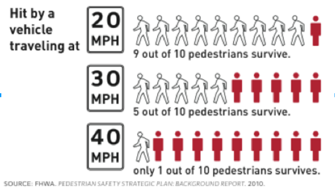
Last Monday, the Seattle City Council unanimously passed a resolution to lower speed limits on all non-arterials citywide to 20 miles per hour, and to lower speed limits to 25 mph on unsigned arterials in the center city, which will dramatically impact streets in our area in a positive way.

20-30-40-fatality-rate

This victory is huge, as the 20/25 mph campaign was one of Seattle Neighborhood Greenways’ citywide goals for 2016, and was accomplished with three months to spare. This legislative achievement is also a big step forward for the citywide Vision Zero campaign.

Lower speed limits pave the way for the Seattle Department of Transportation to be able to more quickly implement traffic calming, due to the fact that the department looks at the relationship between the speed limit and what drivers are actually driving when making determinations.

SDOT has also noted that they had begun setting traffic signals to the new 25-mile-per-hour standard as early as the beginning of 2015, with the result being that traffic appears to be moving more efficiently.

Memorial Walk for Desiree McCloud

13434945_1029450397138219_6947165101764258123_n

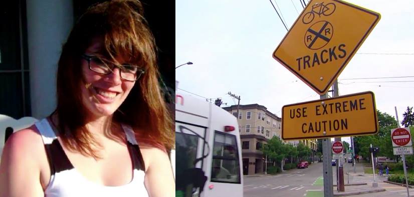
Central Seattle Greenways will lead a Memorial Walk and Solutions Meeting to honor the life of Desiree McCloud and to bring attention to the many collisions that have happened to people who bike along streets with streetcar tracks including East Yesler Way, where Desiree McCloud crashed on her bicycle. The Seattle Department of Transportation is still investigating the cause of the crash. Our solutions meeting afterward will focus on the broader issue of safety in streetcar corridors.

The Memorial Walk will start in front of Bailey Gatzert Elementary School at 1301 E Yesler Way. We will walk across the street to the ghost bike marking where Desiree crashed her bicycle.  Desiree’s mother, Penny McCloud will speak, as well as other community representatives.

Girl Scout leader, Magic player, Geek Girl Desiree McCloud was a dynamic young woman completely engaged in a positive way with many communities in Seattle. Gifts in honor of Desiree can be given to a scholarship fund being set up for girls in science at the Girl Scouts of Western Washington at http://bit.ly/1UgDhyF

Seattle Neighborhood Greenways honors people who have died walking and biking on Seattle streets. We only do Memorial Walks with the full blessing and cooperation of families of the victims. This advocacy honors families, provides a forum for the community to grieve the loss together, and gives communities an opportunity to address street safety.

The Memorial Walk will conclude with a Solutions Meeting with City officials at Yesler Community Center at 917 E Yesler Way to look for solutions to make our streets safer. Central Seattle Greenways has posted a petition for safer streets with streetcar tracks including East Yesler Way at http://bit.ly/1Q6v91N

Capitol Hill Station Access Audit

BY DAVID SEATER

On February 29, 2016, Central Seattle Greenways volunteers and Seattle Neighborhood Greenways staff met at Capitol Hill Station to conduct an accessibility audit of the station area. We focused on three priorities: safety of street crossings, obstructions in crosswalks and along sidewalks, and sidewalk capacity. The station is expected to serve 14,000 riders every day in 2030, making safety and accessibility of the entrances a significant priority.

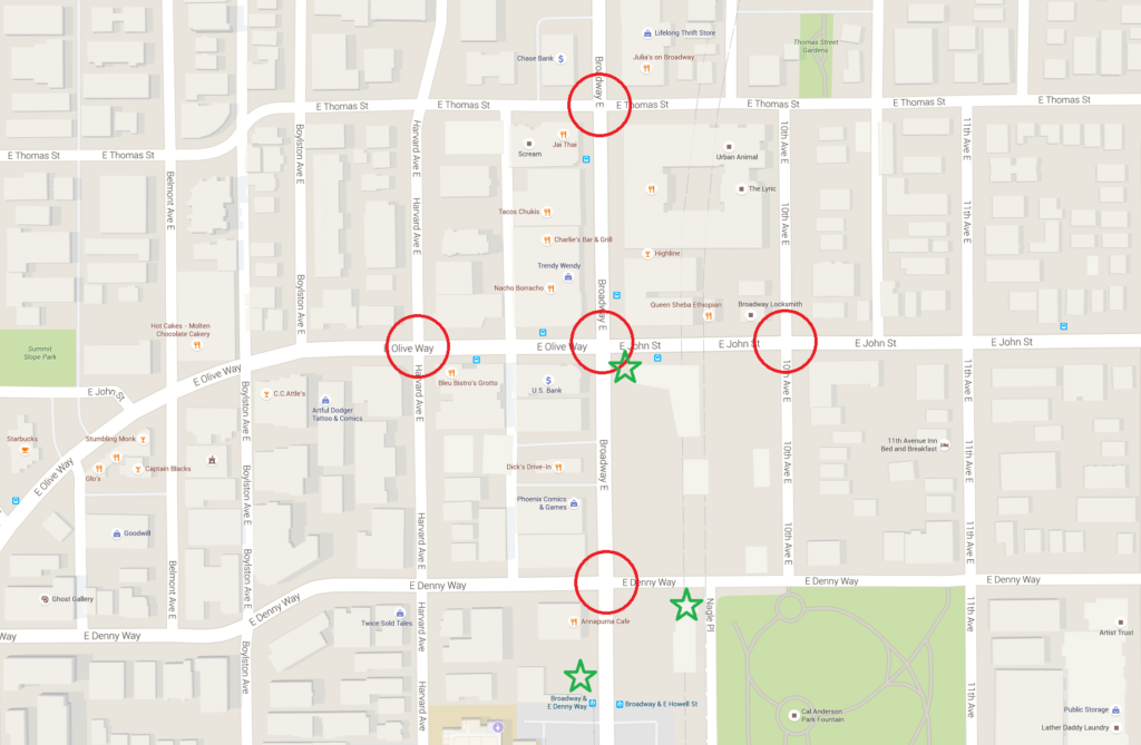
The map below shows the audit area. Intersections that were assessed are circled, station entrances are marked with stars. Specifically, the intersections were: Broadway E & E John St / E Olive Way, Broadway E & E Denny Way, Broadway Ave E & E Thomas St, Harvard Ave E & E Olive Way, and 10th Ave E & E John St.

Map

Assessed intersection are circled in red, station entrances are marked with green stars. (Map from Google Maps, annotations by David Seater)

We identified several common problems at the intersections and the sidewalks connecting them:

  • Obstructions (poles, hydrants) in or very near curb ramps
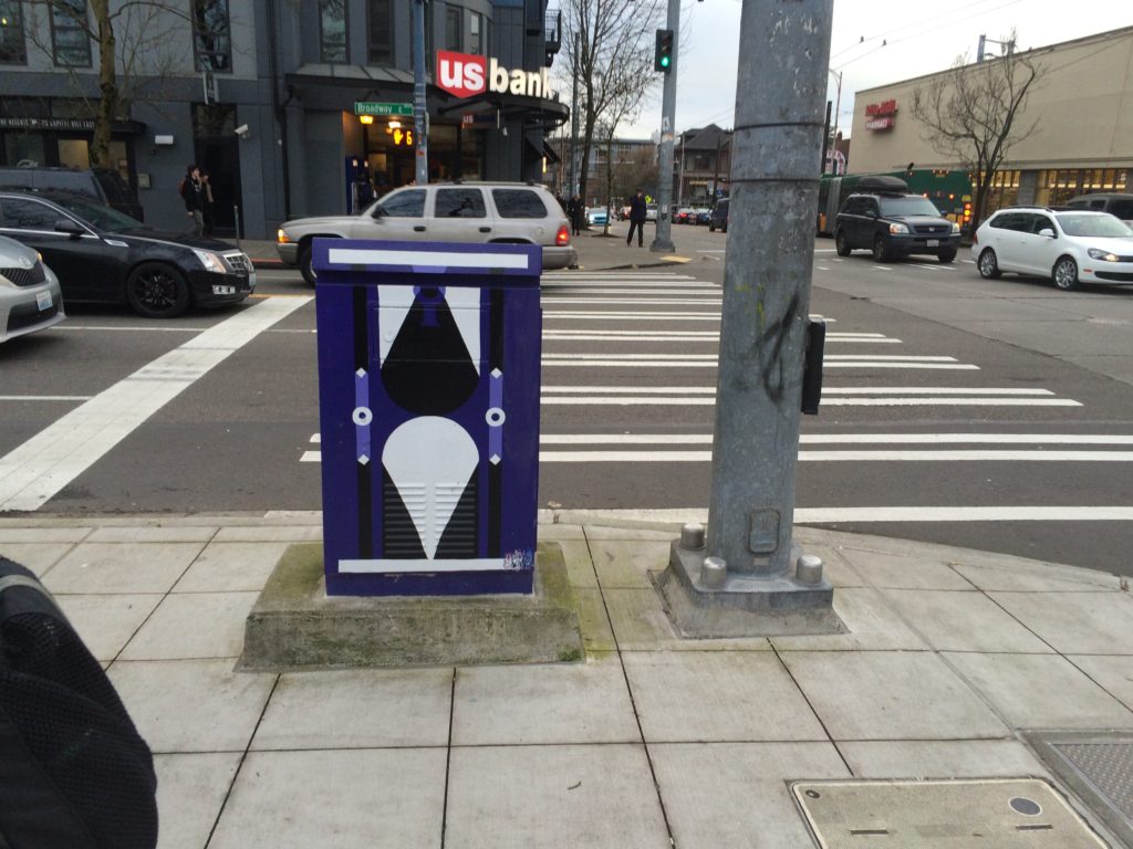
  • Obstructions (poles, signal cabinets, A-boards) blocking painted crosswalks
  • Ramps misaligned on opposite sides of a crosswalk
  • Ramps turned at an angle to the crosswalk
  • Drivers making dangerous turns through occupied crosswalks
  • Difficult crossings of John (at 10th) and Olive (at Harvard)
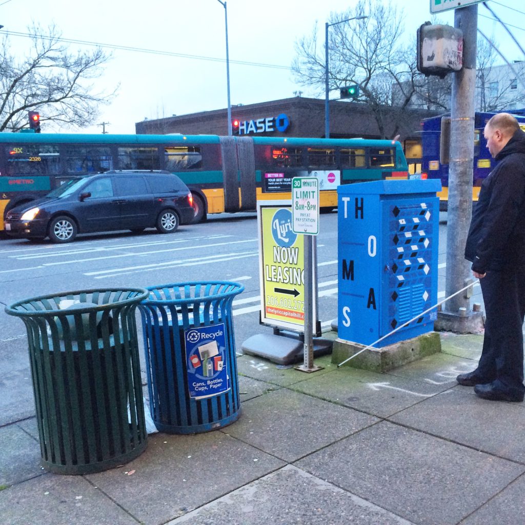
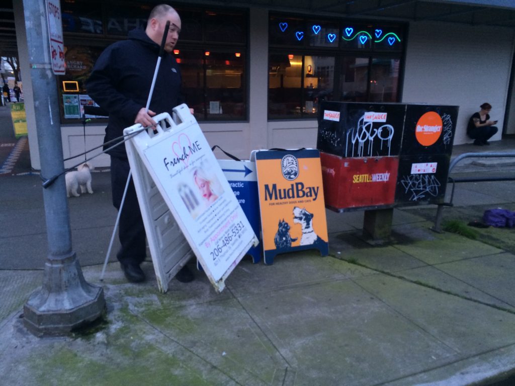
  • Sidewalks narrowed by obstructions (trash cans, newspaper boxes, A-boards, shelters)

Easy Wins – Quick, low cost solutions:

  1. Relocate trash cans and newspaper boxes to be further from crosswalks and ramps
  2. Move trash cans and newspaper boxes closer to the curb to open up sidewalk space
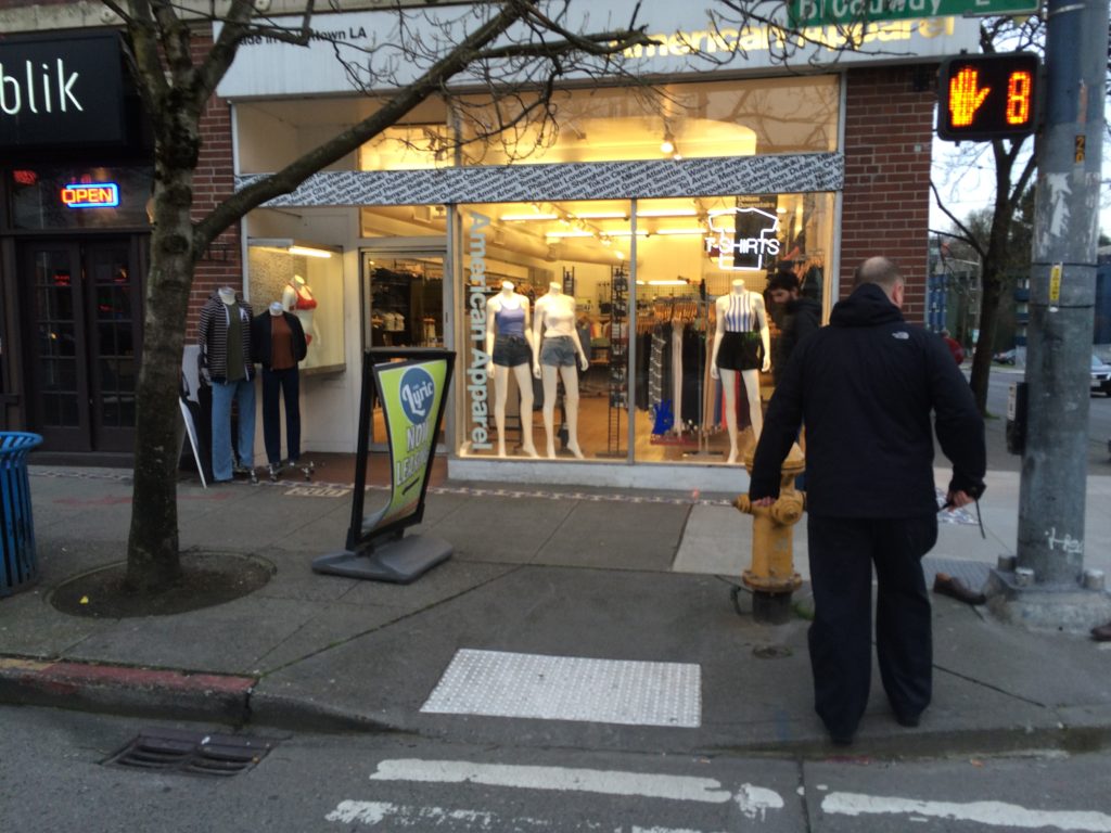
  3. Work with businesses to prevent A-boards from blocking crosswalks and sidewalks
  4. Install crosswalk markings and signs at Harvard & Olive Way and 10th & John
  5. Install better signage and lane markings to prevent left turns from northbound Broadway to westbound Denny Way
  6. Coordinate with King County Metro to place bus shelters without obstructing sidewalks
  7. Patch utility cuts with asphalt to cover existing gravel and create a smooth surface
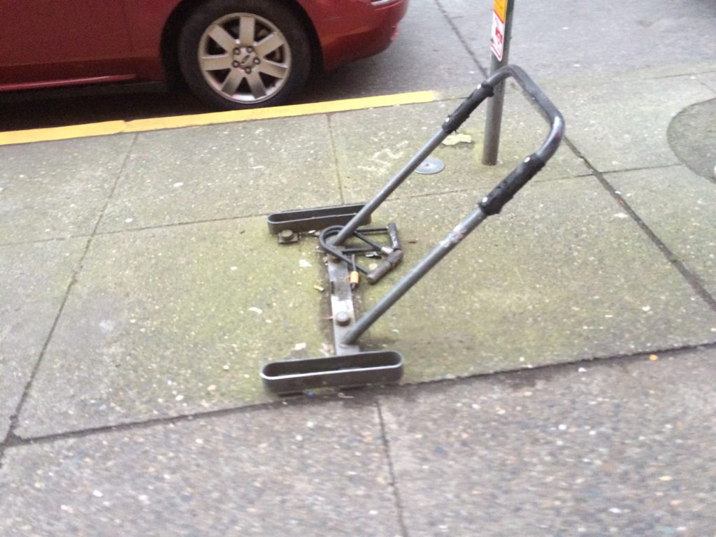
  8. Remove or replace the old bike rack on the sidewalk on the west side of Broadway between John and Thomas

Future Opportunities – Sidewalk and ramps:

  1. Relocate or underground utility and signal control cabinets. Many of these are placed directly in the path of marked crosswalks, creating a barrier and reducing capacity. This is particularly apparent at the main station entrance on the southeast corner of Broadway E & E John St.
  2. Relocate utility and signal poles, many of which are blocking marked crosswalks. Some of the poles are partially blocking ADA ramps.
  3. Relocate fire hydrants that are blocking crosswalks and ADA ramps. These are particularly difficult for people with impaired vision to navigate around.
  4. Align ADA ramps on both sides of crosswalks so that people walking across the street can travel in a straight line without encountering an unexpected curb.
  5. Orient ADA ramps to be aligned with the crosswalk instead of at an angle. In particular, avoid using a single ramp that directs people walking into the middle of the intersection. The new ramp directly in front of the main station entrance at Broadway E & E John St is a particularly egregious example of what not to do.

Safety Improvements – Arterial crosswalks:

  1. Rechannelize E John St / E Olive Way to add left turn lanes at Broadway E. The lack of turn lanes here causes drivers to change lanes unexpectedly as they approach and move through the intersection.
  2. Add left turn signal phases in all directions at Broadway E & E John St / E Olive Way. When the intersection is busy it’s common for drivers attempting to turn left to loiter in crosswalks or in the intersection waiting for a gap in oncoming traffic without watching for people crossing in the crosswalk. This leads to dangerous situations when drivers try to turn through an occupied crosswalk.
  3. Improve the crossings at Harvard & Olive Way and 10th & John with raised intersections, curb bulbs, or other traffic calming measures. Many drivers do not yield to people trying to walk across these intersections.

Examples:

Obstructed crosswalk, Broadway E & E John St

Obstructed crosswalk, Broadway E & E John St (photo from Seattle Neighborhood Greenways)

Obstructed Crosswalk 2

Obstructed crosswalk, Broadway E & E John St (photo from Seattle Neighborhood Greenways)

Obstructed crosswalk, Broadway E & E Thomas St

Obstructed crosswalk, Broadway E & E Thomas St (photo from Seattle Neighborhood Greenways)

Sidewalk obstructions, Broadway E & E Thomas St

Sidewalk obstructions, Broadway E & E Thomas St (photo from Seattle Neighborhood Greenways)

Left-turning car stuck in crosswalk, Broadway E & E John St / E Olive Way

Left-turning car stuck in crosswalk, Broadway E & E John St / E Olive Way (photo from David Seater)

Illegal turns into occupied crosswalk, Broadway E & E Denny Way

Illegal turns into occupied crosswalk, Broadway E & E Denny Way (photo from David Seater)

Failure to yield, 10th Ave E & E John St

Failure to yield, 10th Ave E & E John St (photo from David Seater)

Old bike rack, Broadway E between E John and E Thomas Streets

Old bike rack, Broadway E between E John and E Thomas Streets (photo from Seattle Neighborhood Greenways)

Places for People: 12th Ave Square Park Now Open

12th and james court.jpg

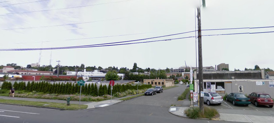
12th Avenue and E James Court in 2008. The property on the left is now an apartment building, the property on the right is now a park. (Click for enlarged view)

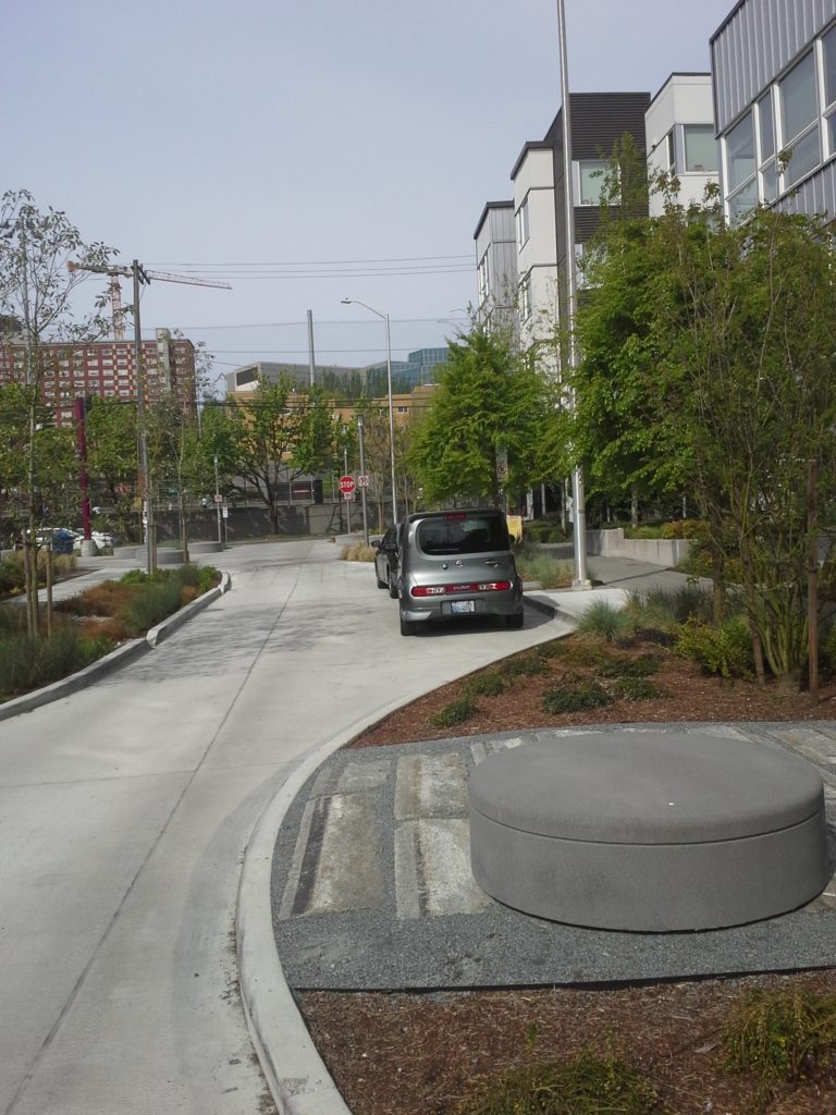
East James Court used to be a little cut through street with parking along both sides, remarkable only in its unremarkableness, a way for cars to get between 12th Avenue and 13th and to store their cars for a two-hour block of time. But not a place where anyone likely felt a strong desire to spend a whole lot of time.

20160416_104048

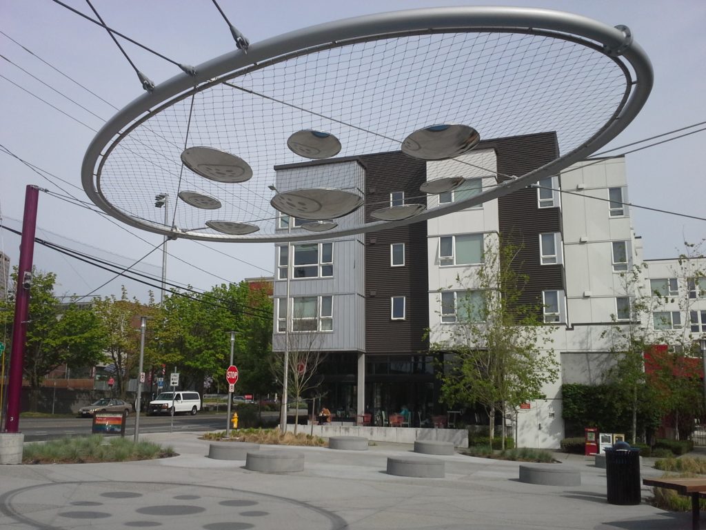
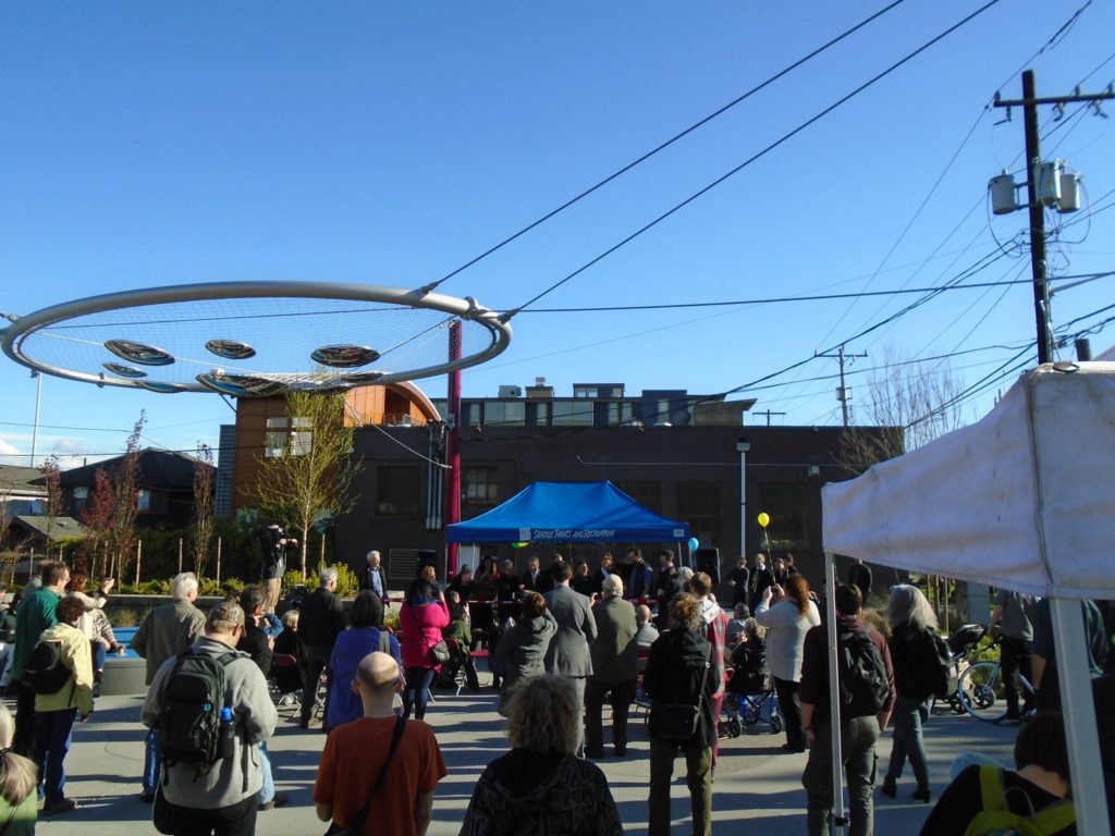
Now East James Court is a complementary space next to the newest park in central Seattle, directly between Capitol Hill and the Central District. On April 14, the grand opening ceremony was held for this park, which includes one of the biggest pieces of public art to be added to Seattle Parks properties in many years, the “Cloud Veil”, designed by Ellen Sollod.

20160416_104304

The grand opening ceremony. Photo credit: No Spandex Required

The grand opening ceremony. Photo credit: No Spandex Required

Visit 12th Ave Square Park to witness another example of spaces for cars becoming places for people. Grab a coffee at Cherry Street, or a bite to eat at Ba Bar, take a seat under the Cloud Veil, and marvel at the difference on 12th Avenue now compared with a few short years ago.


Nominate the Worst Intersection in Seattle

For the past three years, the worst intersections in Seattle for pedestrians, according to the readers of the Walking in Seattle blog, have all been close to Seattle’s downtown, along Aurora and Denny Way.

terryanddenny.jpg-large

2015’s “winner”- Terry Ave and Denny Way.

We suspect our readers have a number of intersections that they would like to nominate as worst in Seattle, most of them within our central Seattle greenways boundaries. You can nominate an intersection through April 30 at Walking in Seattle and readers will decide if it is truly awful enough to be worst intersection in Seattle.

Pavement To Parks at Capitol Hill Community Council

The Seattle Department of Transportation is seeking ideas on what to do with a segment of street on Capitol Hill that it has singled out as being one of several sites that it wants to transform from underutilized street to park space in 2016.

The segment of road is on Summit Avenue between Olive Way and E Denny Way. This one-way segment serves only as a cut-through for traffic coming off Denny or Summit, and creates more potential for pedestrian conflict when there are already several busy streets coming together in the area. It also contains two parking spaces and a Pronto station. The parking will go; the Pronto station is set to remain part of the newly reimagined space.

What to do with this segment of Summit Ave?

What to do with this segment of Summit Ave?


At the Capitol Hill Community Council meeting this Thursday, April 21, SDOT will be on hand to gather feedback about what could be done in the new parks space. For these projects, the changes must not be permanent as the Pavement to Parks projects are essentially pilot projects to see how well the spaces function as park space.

Join us on Thursday and take part in this exciting new program. You can also check out the first Pavement to Parks project in Seattle on First Hill at the intersection of Union, University, and Boylston.

The CHCC meeting will be held at 12th Avenue Arts at 6:30 PM.

Summer Parkways is coming to the Central Area!

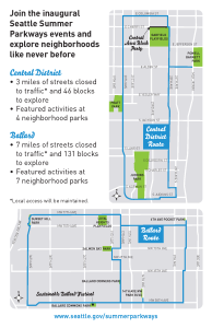
Where can you bike, walk, dance, climb rocks, skateboard, see bike polo, listen to music, and so much more? Summer Parkways! Three miles of streets and the four parks they connect will come alive on Saturday, September 12. Be there! Pages from SSP Postcard

Summer Parkways kicks off with a grand opening celebration of the first section of the new Central Area Neighborhood Greenway, providing safe and comfortable streets for people biking and walking from S. Jackson to E. John. Join us at 11:00 a.m. at Garfield Community Center for the speechifying, ribbon-cutting, and celebratory bike parade.

At the same time, the buff and adventurous Disaster Relief Trials contestants will set off to gather water and other necessities, travel over challenging terrain, and generally do the things we’d need done in a natural disaster. Cheer them on at the start line! (See Tom’s post on Seattle Bike Blog for more info and great video.)

Summer Parkways festivities go from 11 a.m. to 3 p.m. Bike a bit, and then take in some music, bounce around on a harness trampoline, climb a rock, eat some food, and meet some folks from around the neighborhood, other parts of the city, or out of town.

As you’d expect, it’s going to take a lot of volunteers to pull this off. If you’d like to help, go to http://www.cascade.org/summerparkways, and use Cascade Bike Club’s volunteer portal to find the right fit.

The following weekend, on September 19, the focus shifts to Ballard for another family-friendly fun-packed party in the streets.We’re modeling Summer Parkways after the incredibly successful Sunday Parkways events in Portland. Check out this video to see why we’re so excited.

Ted Virdone braves Seattle rain with Central Greenways

Who is willing to give up a Saturday morning to spend it out in the rain?

Central Greenways fearless volunteer leaders - Merlin and Brie - talking at Columbia and 18th  about plans for Columbia St. and Ridge Route greenways.

Central Seattle Greenways volunteer leaders, Merlin and Brie, talking at Columbia and 18th about plans for Columbia St. and Ridge Route greenways.

Happily, several Central Seattle Greenway volunteers and Ted Virdone, a staff member for Seattle City Councilmember Kshama Sawant. We met on Saturday, January 17 at a cafe for a quick ‘briefing’ before heading out on a bike tour of planned future greenways. It was an exciting opportunity to educate Ted and Councilmember Sawant on Central Seattle Greenways and the work happening in our neighborhood to make streets safer for all users.

After visiting one of the first implemented greenways in the East District, we set out to explore short segments of multiple routes that the community is hoping to see established in the near future, including:

  • Columbia St. Greenway
  • Ridge Route Greenway
  • Union St. Protected Bike Lane
  • 27th Ave Greenway


You can help move these and other projects forward in 2015. Already this year we’re seeing movement on the Madison BRT Project, construction of the Central Greenway paralleling 23rd Ave from Rainier Ave S to Montlake, and Vision Zero. Come out and join your neighbors in a movement for safe streets.

Ted Virdone, surrounded by Central Greenways volunteers, discussing a future greenway route in the central neighborhood.

Ted Virdone, surrounded by Central Greenways volunteers on January 17, discussing a future greenway route in the central neighborhood.

Central Seattle Greenways meets the second Monday of each month at 6pm. Check our Facebook page or sign up to join our email list for details of upcoming meetings and projects.